
DJI Mavic 3 Enterprise vs Matrice 4E: Which RTK Mapping Drone for Surveyors and Construction
Surveyors and contractors keep asking the same question: is the newer Matrice 4E worth the step up from the Mavic 3 Enterprise? Both have mechanical shutters and RTK. The differences are in speed, obliques and low-light capability — here is how they play out on real sites.
.webp)
Side by side
| Mavic 3 Enterprise (M3E) | Matrice 4E (M4E) | |
|---|---|---|
| Wide camera | 4/3 CMOS 20 MP, mechanical shutter, 0.7 s interval | 4/3 CMOS 20 MP, mechanical shutter, 0.5 s interval |
| Tele camera | 1/2" 12 MP, 56× hybrid zoom | Medium tele 48 MP + 12 MP tele, 112× hybrid zoom, laser rangefinder |
| RTK | RTK module (add-on) | RTK module (add-on), Smart 3D Capture, Smart Oblique |
| Obstacle sensing | Omnidirectional vision | Omnidirectional vision, low-light capable |
| Flight time | Up to 45 min | Up to 49 min |
| Weather | Not IP rated | IP55 |
| Transmission | O3 Enterprise, 15 km FCC | O4 Enterprise, 25 km FCC, 4G option |
| Weight | ~915 g | ~1.2 kg |
| Dealer price | Basic Combo $2,209.66 | Plus Combo $3,675 |
Mavic 3 Enterprise: proven, and now 33% off MSRP
The DJI Mavic 3E put survey-grade mapping into a sub-1 kg folding drone. The mechanical shutter eliminates rolling-shutter distortion, the RTK module delivers centimetre positioning and DJI Terra or third-party software turns a 20-minute flight into an orthomosaic and point cloud. At $2,209.66 for the Worry-Free Basic Combo it is the most cost-effective RTK mapping platform DJI has offered. For firms adding aircraft to an existing M3E fleet, staying on one platform simplifies training and spares.
Matrice 4E: faster, weather-rated, more versatile
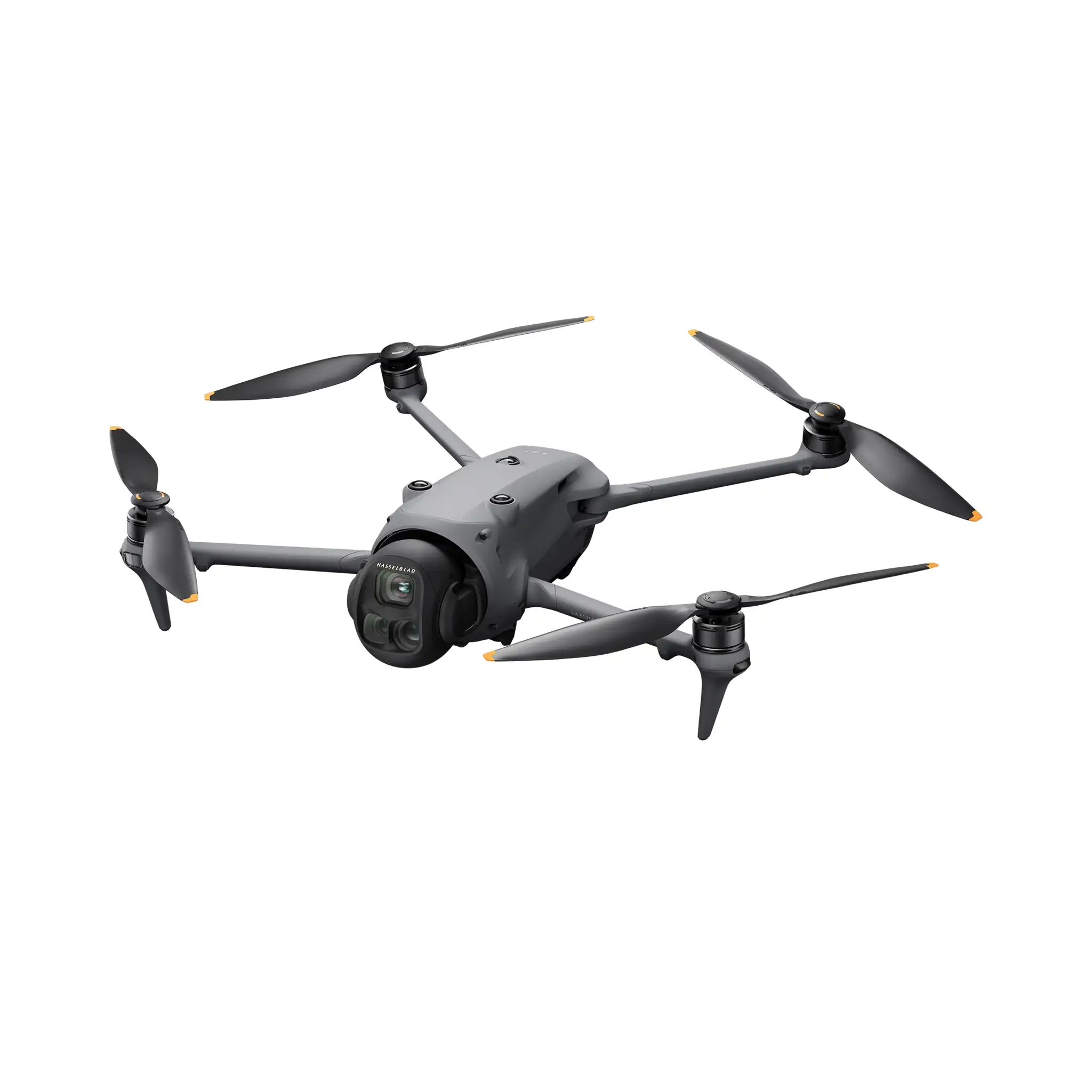
The DJI Matrice 4E keeps the 4/3 mechanical-shutter camera but adds a faster interval, Smart Oblique for five-angle capture in a single pass, a longer tele with laser rangefinder for remote point measurement, IP55 weather rating and low-light obstacle sensing. On a 40-hectare site that typically means one battery fewer and a full 3D model rather than just an orthomosaic. It also doubles as an inspection tool: the 112× zoom and rangefinder let you check a crane or slope from a safe distance.
Accuracy expectations and workflow
- Positioning: use the D-RTK 3 base station or network RTK for a fixed solution during flight. Both aircraft record PPK data as a fallback.
- Ground control: with RTK fixed you can reduce GCPs to a few check points for QA; for boundary or engineering deliverables keep independent checks.
- Overlap and GSD: 75/70 overlap at 1–2 cm GSD is a common starting point; Smart Oblique on the M4E improves façades and volumes.
- Processing: DJI Terra (licensed per device), Pix4Dmatic, Agisoft Metashape or your existing pipeline. Both cameras export georeferenced JPEGs with RTK metadata.
When to step up to the Matrice 350 RTK or 400
Choose the DJI Matrice 350 RTK with the Zenmuse P1 (45 MP full-frame) for the highest photogrammetric quality on large corridors, or the Zenmuse L2 when you need LiDAR through vegetation. The DJI Matrice 400 adds endurance and multi-payload capacity for combined LiDAR-plus-RGB missions. Our Matrice comparison covers these platforms.
Recommendation
- Budget-conscious surveyors, existing M3E fleets: Mavic 3E Worry-Free Basic Combo plus RTK module and D-RTK 3.
- Construction progress, volumes, 3D models, mixed inspection duties: Matrice 4E Plus Combo.
- Corridor mapping, LiDAR, forestry: Matrice 350 RTK / 400 with P1 or L2.
Every mapping quote from ASI Computer lists the RTK module, base station or NTRIP option, batteries, Terra licence and training, with lead times. Start on our Enterprise page or WhatsApp our DJI team with your typical site size and deliverables.
Products in this guide
.webp) 33% off MSRP
33% off MSRP
DJI Mavic 3E
Surveying+Mapping · 4/3 CMOS · 45Min · O3 · RTK
25% off MSRP
DJI Matrice 4E
Surveying+Mapping+Inspection · IP55 · 45Min · O3 · Mechanical Shutter
.webp) 33% off MSRP
33% off MSRP
DJI Matrice 350 RTK
RTK · IP55 · 55Min · OcuSync 3 Pro · 6S Battery
.webp) 25% off MSRP
25% off MSRP
DJI Matrice 400
Industrial Platform · IP45 · 55Min · OcuSync 2 · Heavy-Lift
Frequently Asked Questions
What accuracy can I expect from the Mavic 3E or Matrice 4E?
With RTK fixed (via D-RTK 3 base or network RTK) and a properly planned flight, both deliver roughly 3 cm horizontal and 5 cm vertical absolute accuracy without ground control points. Adding a few check points is still best practice for deliverables you sign.
Do I need the D-RTK 3 base station?
Not if you have reliable network RTK (NTRIP) coverage on site. In remote areas or where cellular coverage is poor, the D-RTK 3 base station gives you a fixed solution anywhere and is included in many of our survey quotes.
Why is the Matrice 4E faster on large sites?
Its 4/3 CMOS camera with mechanical shutter supports a shorter interval and, with the Smart Oblique function, captures five angles in one pass at higher speeds than the Mavic 3E, reducing flight time by roughly a quarter on comparable sites.
Is DJI Terra included?
DJI Terra is licensed separately (perpetual or annual, per device). Both aircraft also export to Pix4D, Agisoft Metashape, Bentley and Trimble workflows. We include the Terra licence option on every mapping quote.
Sources & Further Reading
Talk to a DJI specialist at ASI Computer
Authorized dealer pricing, volume discounts and honest lead times — reply within one business day.
.webp)
.webp)